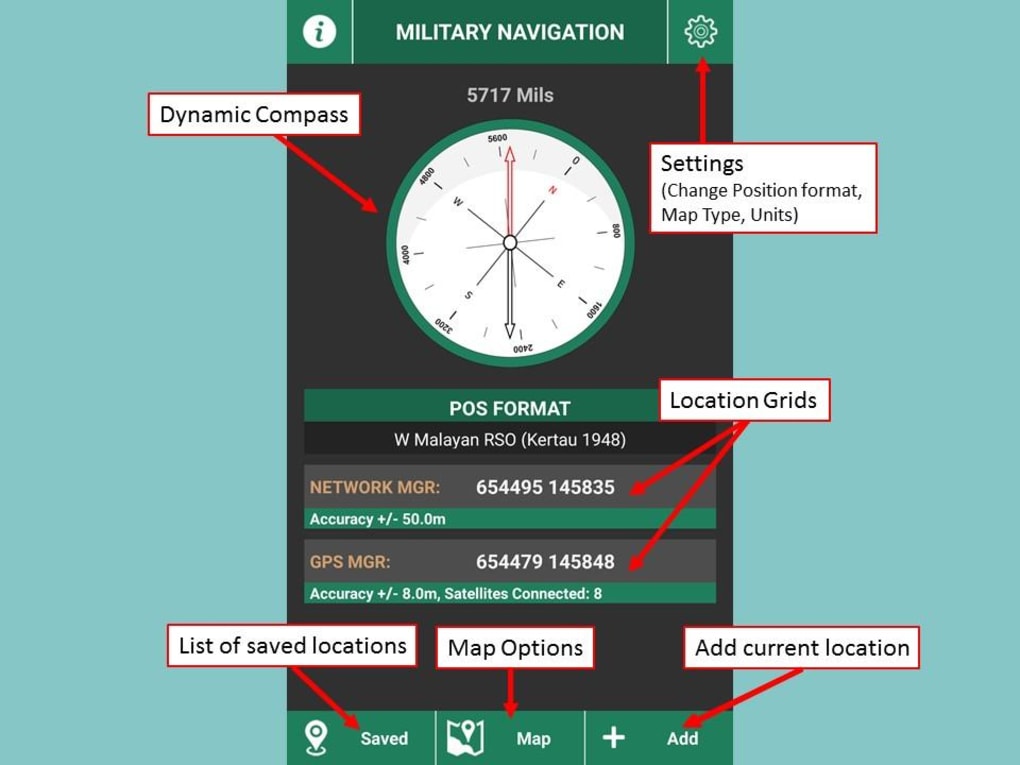
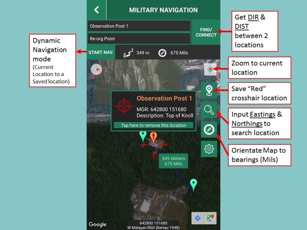
Military Navigation is a free GPS app designed for outdoor enthusiasts who require precise navigation tools. Developed by Lee Wei Min, this app offers a wide range of position formats, including Latitude/Longitude, UTM (WGS84), UPS, Malayan RSO, and more. The app also includes a compass function available in degrees or mils.
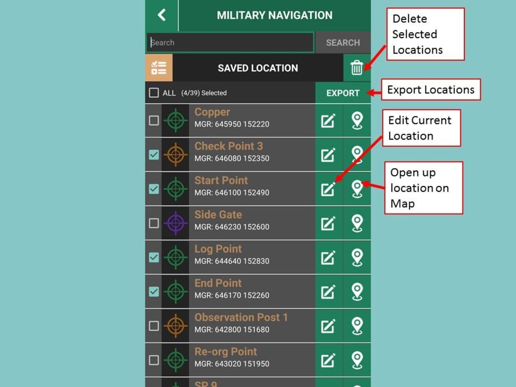
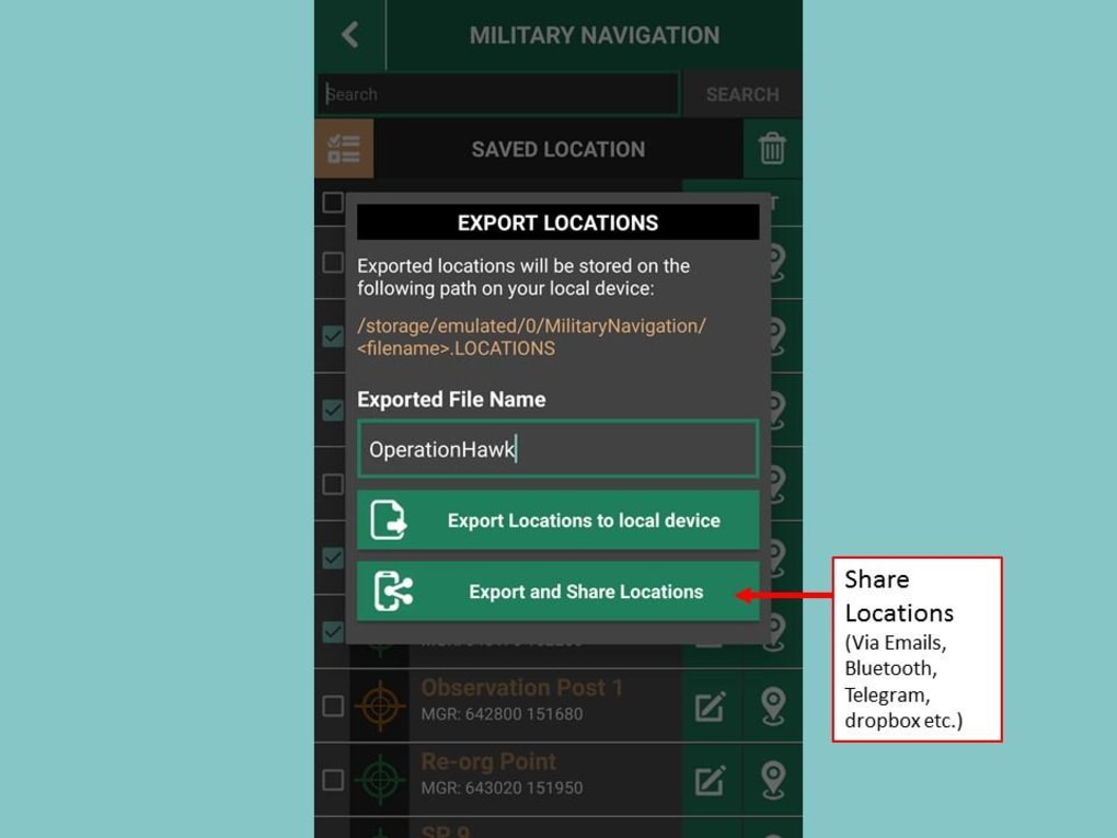
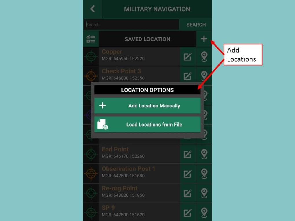
With Military Navigation, you can save your current location and view it on the map. The app offers color-coded location markers for easier identification and allows you to make changes to saved locations. You can also share your locations via email, Bluetooth, Telegram, or other options. The app includes a grid conversion feature that converts Lat/Long to UTM and a search grid option.
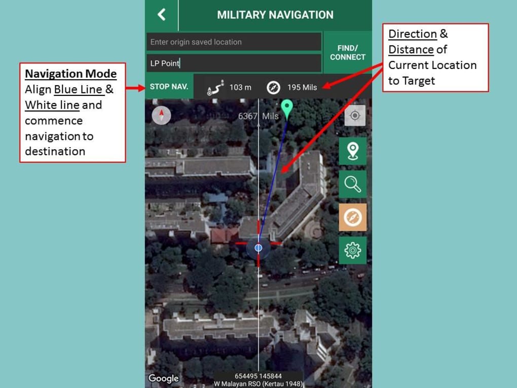
The dynamic map feature allows for bearing orientation, and you can display direction and distance between two locations. The navigation function enables you to navigate from your current location to your destination. Military Navigation is completely free and has no ads.
Overall, Military Navigation is a reliable and easy-to-use GPS app that provides a wide range of features for outdoor enthusiasts. Whether you are hiking, camping, or exploring, this app can help you navigate with precision and confidence.
Version
2.0
License
Free
Platform
Android
OS
Android 9.0
Language
English
Downloads
2K
Developer
Lee Wei Min